Folks , those who are a bit familiar with Yoga , may have heard the idea that human body has 7 "Chakras" or 7 VORTEXES of subtle energy .
Similarly , in Hindu & Buddhist traditions , our planet too is believed to be a sentient "being"
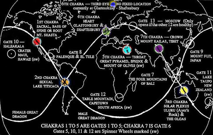
(like the living Earth or Gaia concept) that has 7 Chakras . One interesting similarity amongst these 7 locations on our planet is - they are all located near rich sources of fresh water , from deep inside the Earth :-
Our beautiful Planet Earth is a conscious and vibrant living entity. As our body has 7 major Chakras, so does the Earth.
Energy flows through each of Earth’s main Chakra and makes up the spiritual body that is our world. The Chakras of the Earth are connected by energy circuits called Ley lines. This planetary grid system has been known and mapped for Millennium.
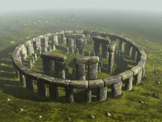
Ancient civilizations revered Earth as a sacred entity. They believed her to be their “Great Mother” and often built their megalithic sacred monuments in areas they considered “Earth’s Highest Energy Vortexes” or “Earth Chakras”. Structures like Stonehenge, the Pyramids of Egypt and Mayan, Aztec, and Incan monuments along with many temples, churches, and pilgrimage sites are now considered powerful energetic spots.
Visiting these sites, especially to mediate and make ceremony, can result in strong connections with mother Earth, opening your own Chakra centers, and the ability to be a stronger conduit of universal energy
Here are the most commonly accepted geographic locations of the planet’s chakra system and what they represent spiritually. (It is thought that the chakras can shift locations based on planetary cycles):
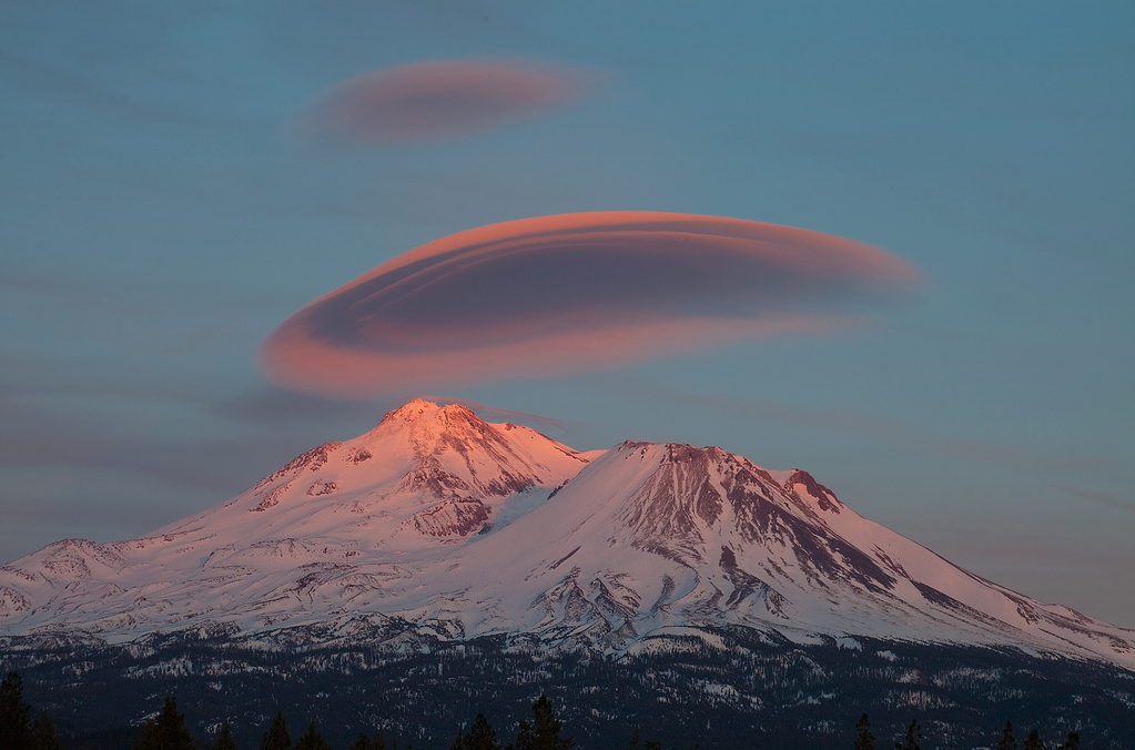
Corresponds to the Root or Mooladhara Chakra. Mt. Shasta in California is considered the root chakra of the planet. (Some also say this is the 5th chakra of the planet.). This energy center is considered primal and ‘base.’
Here is where the universal life force is considered to gather before it becomes life – and is representative of the geysers which rush to the surface with energy the same way that kundalini energy is thought to rush to the crown or pineal gland was awakened from the root chakra.
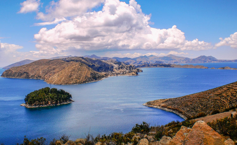
Corresponds to the Sexual Chakra or Swadhistana. Lake Titicaca Peru/Bolivia is considered the 2nd chakra of the planet. The Plumed Serpent – found in many South American myths is representative of the kundalini energy rising to the sexual chakra of the planet.
Also called the rainbow serpent, this center has some of the most ley crossroads or ley lines on the planet, second only to Bali. It is where our primal energy starts to ‘birth’ itself, quite literally into form. Some say that it is through this chakra that the earth overcomes entropy.
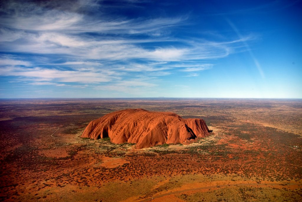
Corresponds to Manipura or the Solar Plexus Chakra. Uluru, otherwise known as Ayers Rock in Australia along with Kata Tjuta are the home of the earth’s 3rd chakra. This huge, monolithic rock is in the Northern Territory of Australia.
This is where Dreamtime legends arise from the Aboriginal people’s. Anangu life revolves around the Tjukurpa (sometimes wrongly referred to as the Dreamtime). To the Aboriginal people, this is the ancestral period of when the world was being formed.
Kata Tjuta is considered Uluru’s sister rock formation. In us, the solar plexus is where we digest emotion – on the planet, it is where we will one day realize a legend told by the Aborigines from the ‘umbilical chord’ of the planet.
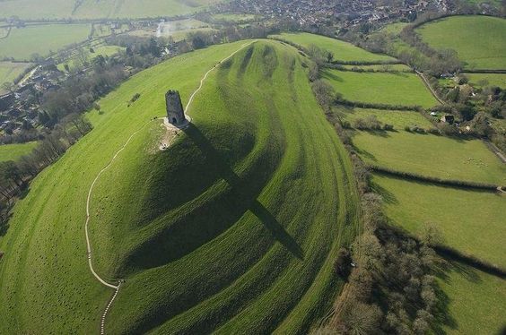
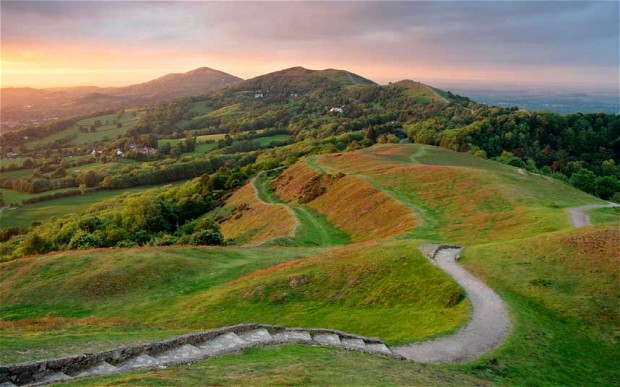
4th Chakra – Glastonbury, Somerset, and Shaftesbury, Dorset
The Heart Chakra, called Anahata in Indian traditions. Glastonbury, Somerset and Shaftesbury, Dorset comprise the center of the world’s heart chakra.
This is the home of the holy grail. It is perhaps, also our greatest contribution to ourselves, and our fellow sentient beings on this planet – to open our hearts to heal the earth and allow her to embody her rightful place as a peaceful, loving satellite in space.
Interestingly, this is an area known for high levels of crop-circle sightings that exhibit magnetic abnormalities.
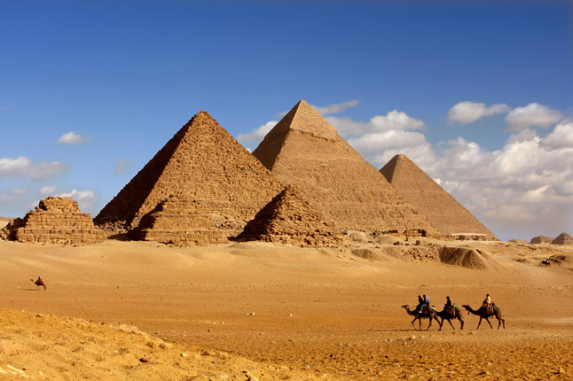
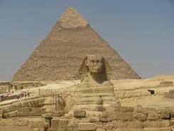
5th Chakra – Great Pyramids near Mt. Sanai and Mt. Olives
The Throat or Vissuddha Chakra. The throat or voice of the planet is the located near the Great Pyramids near Mt. Sanai and Mt. Olives in the Middle East.
This is the one chakra that does not exist at a ley line. It is the exact center of the earth’s land mass as it currently is configured. Modern-day turmoil in the Middle East is considered to be ‘the cries of the mother’ or the voice of the planet calling for help.
6th Chakra – Considered to be in Western Europe
The Pineal Glnd or Third Eye Chakra. This chakra can shift – it is called the Aeon activation Center. Now it is considered to be in Western Europe but will likely move over the next several thousand years.
This chakra is the one that opens portals and allows extra-dimensional energy to enter this world. Just like our pineal gland allows us to recognize other dimensions and realities, so does the 6th chakra of the earth.
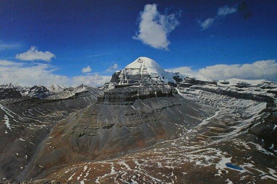
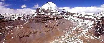
The Crown Chakra or Sahasrara, the Thousand Petaled Lotus, the Highest Energy Center. Mt. Kailas in the Himalayas in Tibet is considered the ‘roof of the world’ and also our earth’s crown chakra.
The highly developed consciousness of Tibetan people, as evidenced through the Dalai Lama’s teachings is indicative of the energy that resides at the crown chakra of the planet. Just as our own crown connects our will with Divine will, so does Mt. Kailas connect the planet with her spiritual destiny.
Earth chakras are like organs that are vital to the health of the world, and to all living beings dependent upon the various environments provided by the world.
Each chakra serves a different function, which is two-fold:
1. To maintain the overall global health
2. To transmit and receive energy encoded with information.
Transmissions from the chakras travel through air, water, or earth.
IF YOU LIKED IT PLEASE SHARE IT WITH YOUR FRIENDS AND FAMILY!
I think Isla de Ometepe in Nicaragua has incredible energy. It is an island located inside of an enormous fresh water lake and comprises two volcanoes – one active and one dormant. The active volcano has a fiery heart and the dormant volcano has a crater lake at its top and a watery heart. The entire island is shaped like an ‘8’ and it pulses with wonderful and positive energy!
There is a misunderstanding here. The HEART chakra is at Avebury in England. The 6th, third eye character is anchored over Glastonbury tor. Under spirit guidance It was collected from Jerusalem in the Aquarian Cross and anchored at the tor in the Eon Shift Ritual in 1990.
At the birth of Jesus it was taken by the magi, the wise ones, in the gold, frankincense and myrrh and anchored in Jerusalem.
At the end of this Eon in approx. 2000 years out will be taken to Arecife in Brazil where it will remain for the following 2000 years.
Mt. Shasta is not the Root Chakra of Earth. It does not meet any of the criteria of a root chakra. It is not hot, dry, or red, nor does it emanate fiery Kundalini power. That mantle goes to Sedona. Mt. Shasta is green, wet, lush and it emanates Heart Chakra energy. People go to Mt. Shasta for Heart Chakra activation and Sedona for Kundalini activation. Sedona, the Roor Chakra, is on the opposite side of the world from Mt. Kailash, the Crown Chakra.
The 7th chakra is one soul
In order to see start at the center
Before u can see what is in front of u
U have to go back where u came from
Your answers are the pyramids
The problem is this:
If u see a triangle before a square your compus is off
2 is before 3
Geometry starts tru
Before u look up at the pyramid and see 3 you have look down on it and see the square 4
I know how it was built
Folks , to those who're wondering - what does Chakra actually mean ?? Well , the simplest answer is that Chakras are Scalar Energy vortexes . Another name for Scalar energy is Vril energy
The human body has 7 Chakras , so does planet Earth & these are connected by invisible leylines . Like any other Vortex (eg. whirlpool) , Chakras on Earth create a suction force . However , since the Earth's Chakras are directed inward out , they help create a powerful suction effect that pulls Primary water from deep within the Earth , upto the surface , thus becoming the true "hidden" source of freshwater for some of the largest perennial rivers on the planet .
**Mainstream science continues to insist that perennial rivers are sustained only by snow melt and rainwater - they still refuse to acknowledge the invaluable contribution of Primary water in sustaining all perennial rivers on Earth .
**Now here's another excellent related article on the same subject . This one explains the mind boggling coincidence of how :-
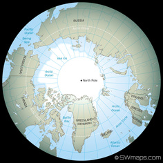
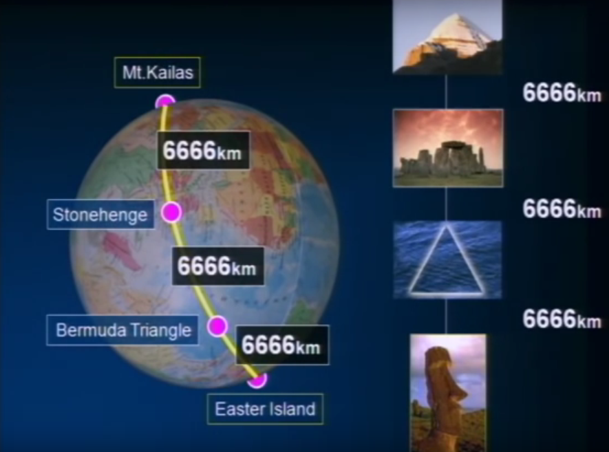
The distance from the North Pole to Mount Kailas = distance of Mount Kailas to Stonehenge = distance of Stone henge to Bermuda triangle = distance from Bermuda Triangle to Easter Island = distance from Easter Island to South Pole = 6,666 Kilometers in each case !!
[ GALACTICFACETS
The earth energy grid is an ancient matrix of lines of subtle forces that form a pattern around the globe. Using scalar waves produced by Mother Earth advanced ancient civilizations built megalithic stone structures along these grid lines and at the intersecting nodal points. Later civilizations built temples, stone circles, medicine wheels and ceremonial structures on the same sites. These grid lines are also called
ley lines.
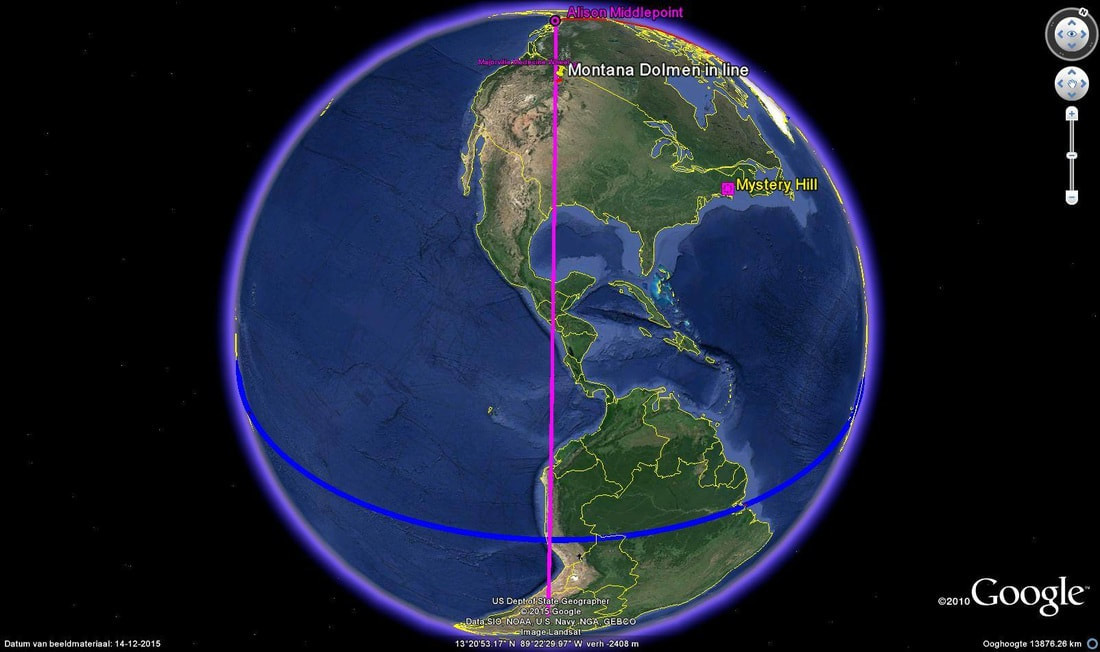
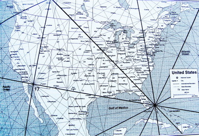
The Montana Megaliths are located precisely on the #17 to #8 grid line
on this world map.
The Montana Megalithic sites line up on a major earth energy grid line that connects Angkor Wat to Nazca, Peru represented by the pink line. The pink line is also known as the Allison Grid Line.
The blue line represents a 24,860 mile long and 62 mile across earth energy grid corridor. This corridor circles the globe connecting sacred and ancient megalithic sites.
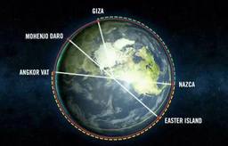
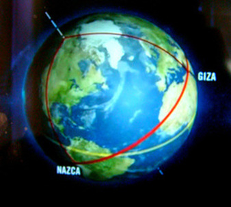
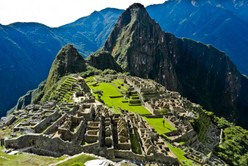
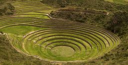
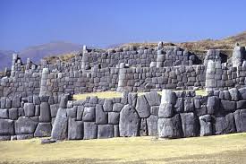
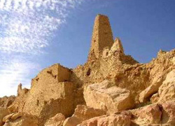
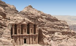
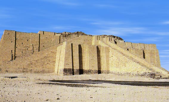
The blue line is drawn along a 62 mile wide earth energy grid corridor which circles the globe passing through Easter Island then the Nazca Lines, Cuzco and Manchu Picchu as well as four other megalithic sacred sites in Peru. The grid crosses the Atlantic ocean to Dogon Country in Mali, the Giza Pyramids and the Siwa Oasis in Egypt. The grid line continues connecting the ancient sandstone architecture of Petra in Jordan to Ur in Iraq.
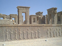
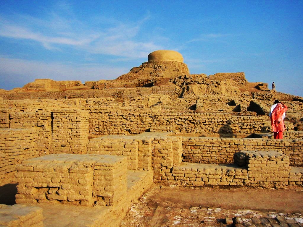
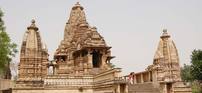
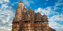
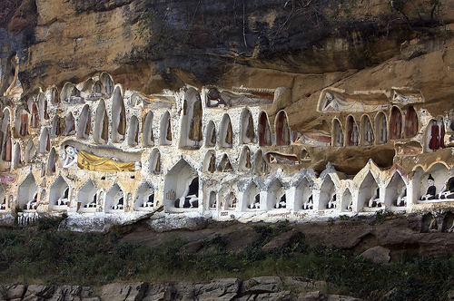
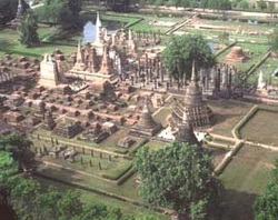
Then the energy grid corridor represented by the blue line crosses Persepolis in Iran (ancient Persia) and on to Mohenjo Daro in Pakistan. Next the grid corridor moves to the sculptured Hindu temples in Khajuraho, India. On to Pyay, Burma which was the ancient capitol of the Pyu nation. Then the grid crosses Sukhothai in Thailand. Next the grid corridor lines up Angkor Wat and Preah Vihear in Cambodia. Then the corridor connects across the Pacific Ocean having circumnavigated the globe and returned to Easter Island.
A more recent video showing these same alignments with more commentary:
MEGALITHIC AND SACRED SITES CORRIDOR
This globe illustrates a 24,860 mile long and 62 mile across earth energy grid corridor.
This corridor circles the globe connecting sacred and ancient megalithic sites.
at 20:20 minutes
23:25 minutes and 35:30 minutes
When this grid corridor is positioned as if it were the equator then the North Pole is demarcated on the Pacific Coast of Canada.
SEE PHOTOS OF THE SITES ON THIS 62 MILE WIDE CORRIDOR AT BOTTOM OF THIS PAGE
The Montana Megaliths are exactly on the 62 mile corridor grid line drawn from Angkor Wat in Cambodia across the Canadian North Pole to Nasca, Peru.
This section is a presentation of images following the ancient megalithic and sacred sites that line up along the global energy grid corridor.
Many of the sites were built over ancient ruins of much older advanced cultures. These photographs follows the same order as the horizontal grid line, narrative and global maps above in the section with the same title.
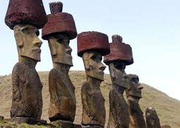
Easter Island in the South Pacific is famous for the Great Moai statures.
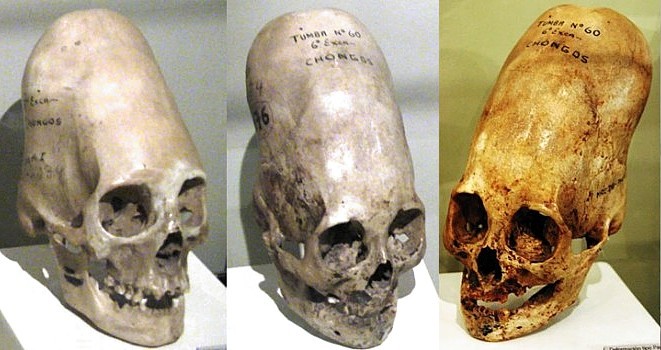
Paracas in Peru is the site where over 300 elongated skulls were discovered. DNA tests show that they are a new human-like creature, very distant from Homo sapiens or Neanderthals.
See Blog Page 01/25/2015
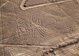
Enigmatic Nazca Lines of Peru are seen only from the air. This single line etching is 165 feet long.
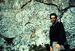
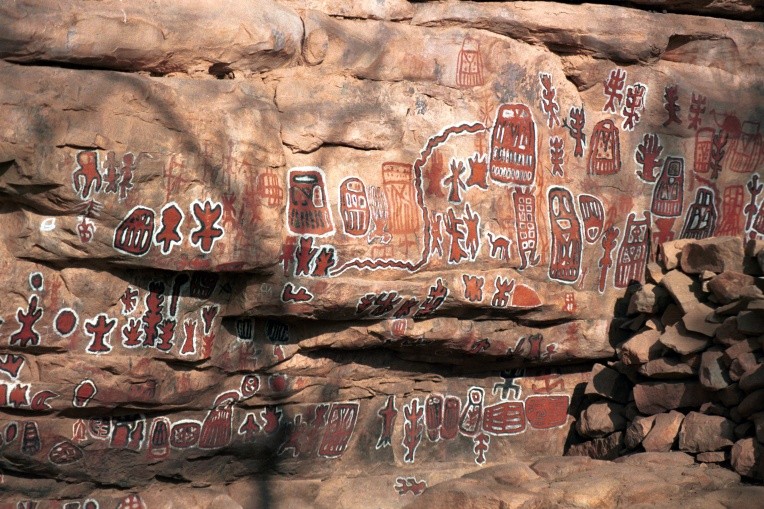
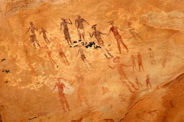
The Dogan Tribe in Mal i, Africa believe they came from a planet that orbits another star in the Sirius system. Cave drawings show Sirius B and Sirius C as well as their trajectories.
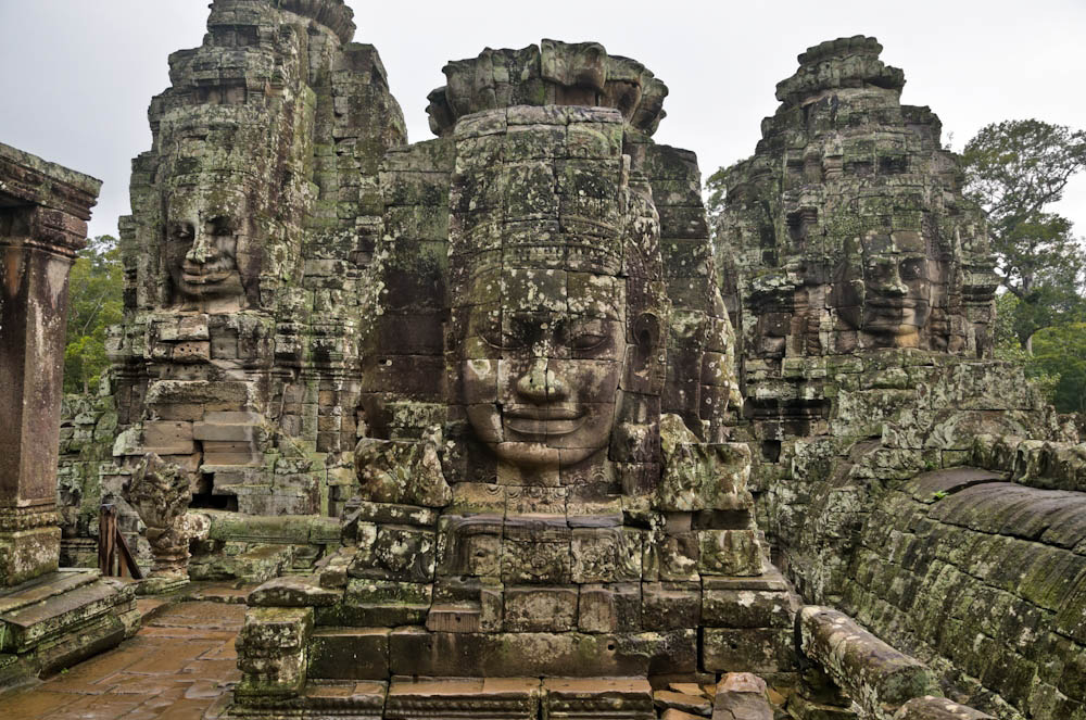
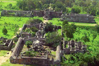
A ngkor Wat was first a Hindu then later a Buddhist temple complex in Cambodia
Preah Vinear in Cambodia is an ancient Hindu temple which is unusual among Khmer temples in that it was constructed along a long north-south axis.
It is truly extraordinary that so many ancient megalithic and sacred sites are lined up along a 62 mile wide corridor around the globe. http://www.youtube.com/watch?v=7p_RD-S7INM At 35:30 minutes
New video that shows the earth energy grid:
Another link to the video:
Pyramids align
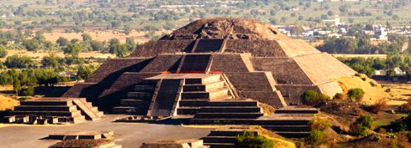
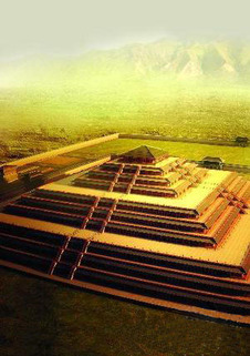
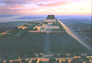
Teotihuacan ('the place where the gods were created) near Mexico City features three large step pyramids.
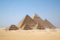
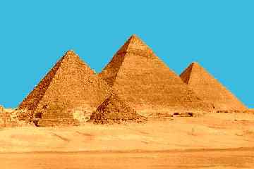
Pyramid complex on the Giza Plateau in Egypt
Hundreds of pyramids were built in the ancient past in Shen-hsi, Xi'an Province of China
The oldest pyramid complexes in Mexico, align with the pyramids in Egypt and hundreds of flat top pyramids in China. This pyramid energy grid line intersects with the 62 mile corridor at the Giza Pyramids.
Joseph P. Farrell explains that "the pyramidal shape itself interacts directly with the physical medium such as in zero point energy or the vacuum flux. Pyramids are hyper-dimensional objects that resonate with the same sort of structure in four or more dimensions. Pyramids are machines that engineer and manipulate
the physical medium directly potentially supplying a limitless supply of energy." https://www.youtube.com/watch?v=wKDxCbKvtpA at 22:11 minutes.
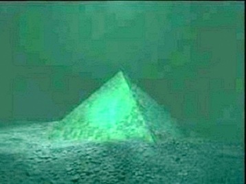
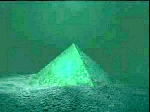
Larger than the Great Pyramid at Giza a crystal pyramid lies under the Bermuda Triangle. This made national news on
May 8, 2013.
See Ancient Technology Page The crystal pyramid found in the Bermuda Triangle and the pyramids at the Shen-hsi site in Xi'an China are 180 longitudinal degrees apart and at the same latitude.
" Emperor Qin Shihuang’s tomb (home of the terracotta warriors in Xi'an province) was proven (using radar and other remote sensing technologies) to be a nine-stepped pyramid, very similar to those in Central America."
The image on the left is the shape they believe the pyramid takes. http://survive2012.com/asia-pyramids/
Energy grid structures are 6,666 kilometers apart
Klaus Dona recently made another fascinating correlation about the global earth energy grid.
The original Youtube which was presented in German was taken down from the internet. The illustrations were in English and I have captured some of his information here.
In 1970 while living in San Jose, California I became friends with Marcel Vogel who invented the Vogel Crystals. Marcel told me about the discovery of an underwater crystal pyramid in the Bermuda Triangle. Linda Moulton Howe announced the Alaskan Pyramid discovery. I did the math and added this branch of the grid structure to Klaus Dona's original discovery.
The Pyramids of Giza are 6,666 kilometers from
the North Pole.
Starting at the North Pole draw a trajectory exactly 6,666 kilometers to Mount Kailash in Tibet.
Mount. Kailash has the unique distinction of being the world's most venerated holy place. It is considered an supremely sacred site of four religions and billions of people.
Mount Kailash to Stonehenge is 6,666 kilometers .
Stonehenge to the Crystal Pyramid in the Bermuda Triangle is 6,666 kilometers .
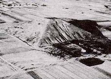
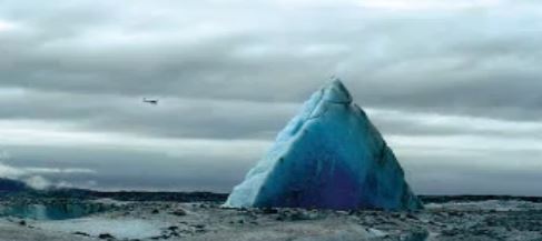
From the Crystal Pyramid in the Bermuda Triangle to the Alaskan Pyramid is 6,66? kilometers .
Six thousand six hundred and sixty something kilometers is the closest that I could calculate based on google maps and coordinates. This Alaskan pyramid located within the Alaskan Triangle is 650 feet high and mostly underground.
More pyramids were discovered in Alaska in 2016.
Bermuda Crystal Pyramid to Easter Island is 6,666kilometers .
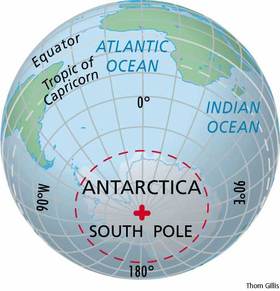
Easter Island to the South Pole is 6,666 kilometers .
Megalithic sites and temples are built where these energy grid lines cross at conductivity/ discontinuity points. Newer temples and monuments were often built over far more ancient sites.
Bruce L. Cathie wrote in 1997 that the stones monuments in Britain form a gigantic power network and
are aligned in a single geometric pattern. Comparing the positions on ordinance survey maps of over
3,000 prehistoric stone circles and single standing stones lead to the conclusion that "every one is aligned to neighbors up to twenty miles away at an angle of 23.5 degrees or a multiple of that angle."
Dolmens on the Montana Dolmen Map appear to be lined up on a trajectory at about the same 23 degree angle. See Dolmens in Montana Page.
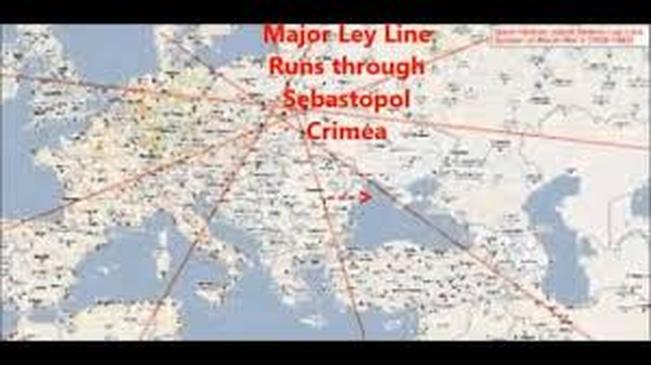
Thirty-seven pyramids were discovered underground beginning in 1999,
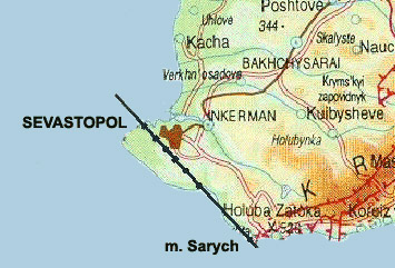
in Crimea near Sebastopol. Crimea is an autonomous republic of Ukraine, situated on the northern coast of the Black Sea, occupying a peninsula of the same name.
Twenty-eight of these pyramids form a huge rhombus with the 29th one in the center. Seven more form a smaller rhombus with the 37th pyramid in the center.
Instruments invented by Vitalij Gokh, the discoverer of the pyramid complex, revealed that from the top of the structure, three beams of energy emanated, at frequencies 900x109 Hz, 700x109 Hz and 500x109 Hz. Around the pyramid, a field of
10x109 Hz was noticed. The digging also revealed signs in the surrounding layers that the pyramid had originally been open to the air. Some of the pyramids are under water.
The Major Ley Line map shown above is slightly different from the Planetary Grid System map. Maps vary however every map that I have studied lays out a pattern of an earth energy grid system that is very similar.
Seven pyramids line up along one side of the major rhombus across the southern edge of the Crimean Peninsula.
{ 4 x 7 = 28 pyramids }
It was also found out that on the same line, in one direction is Stonehenge, and in opposite direction are pyramid in Bhutan which was originally part of Tibet.
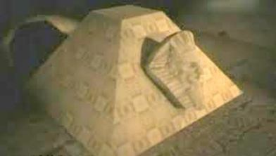
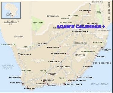
Adam's calendar, south africa on major nodal point
"A new discovery of an ancient circular monolithic stone calendar site in Mpumalanga has proven to be at least 75,000 years old, pre-dating any other structure found to date. It estimated that there are well over 1,000,000 (one million) ancient stone ruins scattered throughout the mountains of southern Africa. Various tools and artefacts that have been recovered from these ruins show a long and extended period of settlement that spans well over 200,000 years." Michael Tellinger
Adam's Calendar was built on the # 41 major energy grid nodal point inSouthern Africa .
See Ancient Technologies Page for more information about the cymatic sound signatures of these stone circles in Southern Africa.
ALONG THE Earth energy grid corridor IN NORTH AMERICA
The major north/south vertical grid corridor connecting nodal points #8 to #17 which passes through Montana is covered in great detail on the Montana Earth Energy Grid Page. This section focuses on major nodal point #18 at the confluence of 10 major grid lines which is off the coast of Florida and the major grid corridors extending from confluence nodal point across Cuba, Mexico and the USA.
These maps were reprinted to make it easier to reference the sites described below. Each of these major grid lines represent a 100 meter (62 mile) wide earth energy corridor. Intersecting the landscape are numerous minor grid lines that meet at nodal points.
More and more proof of ancient technology, pre-sanskrit stone writing, archeo-astronomical sites, dolmens, rock cairns and stone circles are being re-discovered in the United States. Many of these sites were built along the major earth energy grid lines and where these lines intersect at nodal points. Native tribal settlements were built over and around more ancient sites.
So, lets locate some of these enigmatic sites on the energy grid map of the United States.
MAJOR NODAL POINT #18: JUST OFF THE COAST OF FLORIDA
Off the coast of Florida, at nodal point #18 is the location of a crystal pyramid found in 1968 and recently rediscovered by a French team in the Bermuda Triangle . This structure is larger than the Giza Pyramid.
See Ancient Technology Page for details.
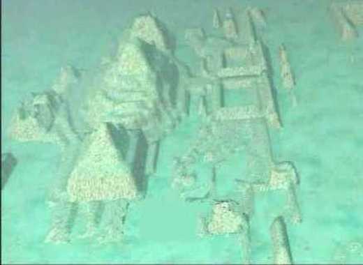
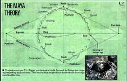
Extending south from nodal point #18 are 2 major and 3 minor grid lines that dissect Cuba . Just off the coast of Cuba is this underwater pyramid complex.
See Ancient Technology Page for the story.
MAJOR GRID corridor # 18 - #32 CROSSES FLORIDA AND MEXICO
Continuing to rotate clockwise from nodal point #18 the next major grid corridor #18 to #32 crosses the tip of Florida and then projects to Teotihuacan pyramid complex near Mexico City. The Miami Circle in Florida once served as the "foundation slots" for a ring of 30 upright stones which was an archeo-astronomical Stonehenge-like device for observing the solstices and equinoxes. http://www.labyrinthina.com/the-miami-stone-circle.html
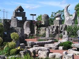
Near Miami, Florida is the Coral Castle built by Edward Leedskalnin who devised a means to single-handedly lift and maneuver blocks of coral weighing up to 30 tons each. Logic suggests that he used the scalar wave energy of the nearby earth energy grid nodal point.
MAJOR GRID corridor # 18 - #17 CROSSES TEXAS
Rotating clockwise the next major grid corridor extends from nodal point #18to #17 across Texas . The nodal point in east Texas aligns 8 minor grid lines. In this area the Caddoan Mississippian culture built mounds and settlements although there has been little excavation.
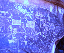
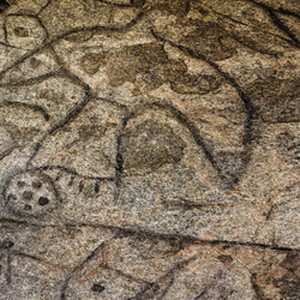
Continuing west along the #18 to #17 grid line near El Paso, Texas is Alamo Canyon harboring a trove of ancient art (photo left) and archaeological sites. Alamo Canyon contains at least 16 rock art panels—more than 500 images carved (petroglyphs) or painted (pictographs) on the rocks.
MAJOR GRID corridor #18 - #8 CROSSES THE USA DIAGONALLY
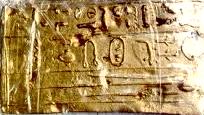
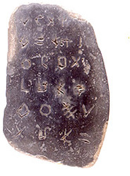
Follow the next major grid corridor diagonally across the USA from nodal point #18 to #8 on the world Planetary Grid Map above to southern Illinois . Burrows cave contained several examples of the pre-Sanskrit writing which matches the same script found around the world and in Montana. Artifacts of pure gold that appear to be Egyptian were found in the cave.
Klaus Dona confirmed that the stones in Illinois are the same Pre-Sanscrit writing found around the globe. He recently stated that ground penetrating radar has revealed more channels containing artifacts in Burrows Cave.
See Ancient Pictograph Page.
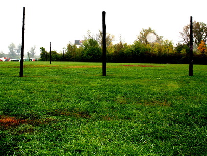
CAHOKIA IS ON THE EARTH ENERGY GRID
Following the #18 to #8 energy grid corridor northwest toward Canada the next ancient site is Cahokia, Illinois.
Warren Ramey, former Chief of the Southern Cherokee, took us there in 2008 to teach us about the calendar and the ancient civilization of his ancestors.
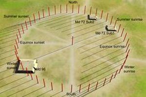
The calendar of Woodhenge is illustrated on a display above my right shoulder.
A white orb appears in the calendar of this photo that I took of Woodhenge at Cahokia. Posts were inserted into deep holes in the ground to illustrate the alignments of an ancient calendar system.
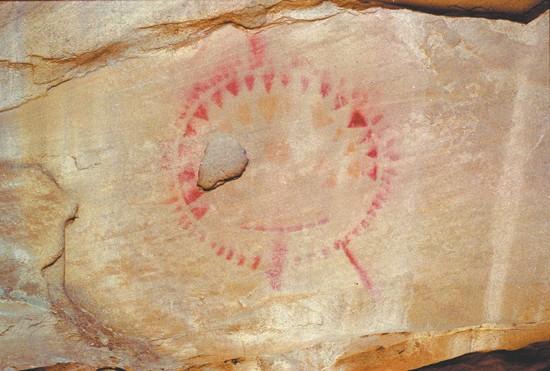
Warren Ramey was very excited when I showed him a photo of a pictograph calendar in Montana which shows a line extending out of the circle at five o'clock. This calendar is found at the largest
poly-chrome pictograph site in North America.
Just behind my right shoulder displayed in the photo of Woodhenge (left above) note that a corridor extends out of the calendar circle at about five o'clock.
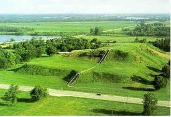
Monks Mound in Cahokia is the largest Pre-Columbian earth works in the Americas and the largest pyramid north of Mesoamerica. (Wikepedia).
Inside some of the buildings the scientists found pigment stones, crystals, and “unusual” half-spheres made of fired red clay — items thought to be key to Cahokian rituals.
A view from the top of Monk's Mound in Cahokia includes the city of St. Louis, Missouri which was built across the river. One of the greatest cities in the world, Cahokia was larger than London in the year 1250.
Cahokia, illustrated above at it's zenith, covered at least six square miles and included about 120 human-made earthen mounds in a wide range of sizes, shapes, and functions.
" Most Americans have no idea that ancient cities with advanced architectures once dotted the ancient North American landscape. It is estimated that there once existed over 200,000 cities, structures and mounds across the continent." https://www.youtube.com/watch?v=V_FgouKeQ9E
Writing Rocks in North Dakota is on the #18 to #8 energy grid corridor near the Canadian border. This photo is actually petroglyphs that have been colored in to become more visible. This is a different script than the Pre-Sanskrit writing, however most of the stones in the patterned structures have been removed by farmers.
Major grid corridor #18 - #9 passes through eastern USA
Back to the major nodal point #18 and rotate clockwise once again to the #18 - #9major grid line corridor that proceeds north crossing the eastern United States through northern Virginia.
Bluemont, Virginia — "Concentric stone circles near rocks weighing more than a ton - apparently aligned to mark solar events - are believed to be part of a Paleo-Indian site that an expert has dated to about 10,000 B.C.
Higher up the mountain are several large boulders that appear to have been stacked on top of each other to create a table-like structure."
By Val Van Meter The Winchester Star
May 10, 2014 It sounds to me like he is describing a dolmen. "In The Mysterious Megaliths of New England , Paul Tudor Angel states, "Located in the heart of modern-day New England stand sites of such great antiquity; sites so enigmatic, so sophisticated and seemingly inexplicable, serious scientists and archaeologists have denied their study because of their monumental implications: It would force them to throw away their pre-conceived notions about the achievements of ancient man." http://s8int.com/page38.html
The most documented stone circle and dolmen site in the United States is in New Salem, New Hampshire. Although this site does not align on a major grid line according to the map it still reveals a pattern of megalithic construction in the US. http://www.faculty.ucr.edu/~legneref/bronze/bronze6.htm
Glenn Beck presented documentation of the policy of the Smithsonian to cover-up and destroy evidence of advanced ancient cultural artifacts and construction in the United States.
Sorry , missed adding - North Pole to Giza Pyramid is also = 6,666 kilometers .
How can there be so many coincidences ?? This can't be just a random coincidence when 6,666 kilometers is exactly 1/6th of the Earth's circumference i.e. 40,000 kilometers !
Imagine that the writing in Mohenjo Daro matched the writing in Easter Islands. What civilization was that, that it had such writing. It isn't Sanskrit at all and, apparently, it isn't Tamil.
@deandddd , also Mohenjo Daro of the Indus Valley Civilisation (now in Pakistan since 1947) is exactly on the OPPOSITE side of the globe to Easter Island , some 20,000 kilometers away .
It's alsmost as if someone from Mohenjo Daro went right through the planet (crossing Hollow Earth) to reach the other side .
The Indus script is logographic (like an advertising logo that uses symbols to convey meaning) - so it's not possible to determine which language , though my personal bet - it's some ancient form of Sanskrit , maybe even the mother of all human languages , Senzar , the multidimensional language of symbolism , who knows ??
Let the mainstream archaeologists go figure that one out !!