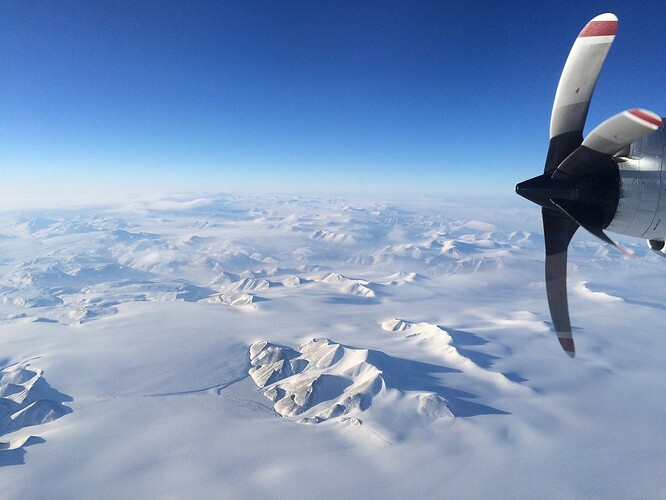
Folks , NASA recently completed the most comprehensive 11 year survey of Earth's Polar regions - under what they call "Project IceBridge" . Their report talks about Gravitational and Magnetic anomalies , both in Antarctica as well as in Greenland....hmm !!
It's another question though , whether they HONESTLY published ALL of their data without manipulating it :)) Anyhow , here are some details for whatever it's worth :-
https://pgg.ldeo.columbia.edu/projects/operation-icebridge
- Operation IceBridge
Operation IceBridge
NASA's Operation IceBridge (OIB) Mission - Monitoring the Earth's polar regions for over a decade
NASA's Operation IceBridge Completes 11 Years of Polar Surveys. Source: NASA
About
NASA's Operation IceBridge (OIB) Mission is the largest airborne survey of Earth's polar ice ever flown. From 2009 to 2019, OIB collected yearly, multi-instrument documentation of the Arctic and Antarctic ice sheets, ice shelves, and sea ice.
Potential Fields Team - Gravity and Magnetics
The LDEO Polar Geophysics Group leads the Potential Fields Instrument Team for Operation IceBridge. Together with partners Sander Geophysics Limited (SGL) and the United States Geological Survey (USGS), we have collected gravity and magnetic anomaly data from Operation IceBridge flights in both Greenland and Antarctica. Anomaly data, along with derived products, are archived and distributed by the National Snow and Ice Data Center (NSIDC).
Image Carousel with 5 slides
A carousel is a rotating set of images. Use the previous and next buttons to change the displayed slide
- Slide 1: The gravity team with NASA's GV. Photo: Matt Linkswiler (NASA)
- Slide 2: NASA's P3 in Thule, Greenland. Photo: Caitlin Locke (LDEO)
- Slide 3: Greenland from NASA's P3. Photo: Caitlin Locke (LDEO)
- Slide 4: NASA's DC8 in Ushuaia, Argentina. Photo: Caitlin Locke (LDEO)
- Slide 5: NASA's GV in Hobart, Tasmaina. Photo: Renata Constantino (LDEO)
Greenland from NASA's P3. Photo: Caitlin Locke (LDEO)
Why Potential Fields?
Gravimeters (gravity meters) measure variations in the Earth's gravitational field. The free air gravity anomaly is sensitive to the density and topography of the Earth. In the polar regions, we use this gravity measurement to create models of the bathymetry, or water depth, under floating ice.
Much of the continental ice shelves surrounding ice sheets remain unmapped due to their inaccessibility; and yet, the seafloor shape has first-order controls over the movement of deep ocean heat that is melting glaciers. The acquisition and modeling of airborne gravity data for bathymetry helps map these inaccessible areas of our planet; thus, improving ocean and climate model projections.
Magnetic anomalies are caused by variation in the magnetic susceptibility of the rocks in Earth’s crust. We fly a magnetometer to measure these anomalies and help build a model of the geology that underlies the polar ice. These models then help us to interpret the gravity field, improve the bathymetry models, and understand the geological setting and history of the polar regions.
OIB Gravity data
| Survey Area | Year | Gravimeter |
|---|---|---|
| Antarctica | 2009-2018 | AIRGrav by SGL |
| Antarctica | 2019 | LDEO airborne Gravimeters |
| Greenland | 2010-2012 | AIRGrav by SGL |
| Greenland | 2017 | LDEO airborne Gravimeters |
OIB Magnetic Data
| Survey Area | Year | Magnetometer |
|---|---|---|
| Antarctica | 2011-2012 | Scintrex CS-3 Cesium Vapor and Billingsley TFM100G2 Fluxgate |
| Greenland | 2013 & 2017 | Scintrex CS-3 Cesium Vapor and Billingsley TFM100G2 Fluxgate |
Access OIB gravity and magnetic data on our OIB Data Page.
To learn more about OIB, please visit NASA's OIB Mission website.
Regards

