Folks , it seems there is quite a LOT of Satellite and LIDAR imagery on the public domain , which we could use for our Hollow Earth research , absolutely FREE of cost :)) Please take a look :-
25 Satellite Maps To See Earth in New Ways [2020]
By: GIS Geography · Last Updated: May 14, 2020
25 Satellite Maps
These are the top 25 satellite maps in 2020.
The best part?
You’ll get to explore Earth in new ways that you’ve never thought possible.
Let’s get started.
Table of Contents
Chapter 1. Satellite Maps
1 Google Maps

Google Maps is the ULTIMATE tool for satellite maps. It’s grown over the years. So has its features:
- Like it’s panoramic street views.
- Its 3D perspectives are mind-blowingly insane.
- And almost everyone’s favorite: finding their house with its solid addressing system.
But the best part about Google Maps is that it’s regularly updated. In fact, it’s hard to find any imagery that’s more than 3 years old.
The only downside I can think of is that you only get ONE snapshot in time. That’s where Google Earth Pro comes in…
2 Google Earth Pro
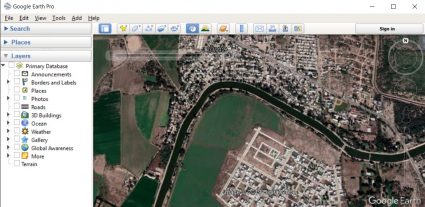
Popquiz, hotshot! Does Google Maps and Google Earth Pro share the same imagery? The answer is: They are completely DIFFERENT from each other.
Google Earth Pro lets you hit rewind in its historical timeline. That way, you can interactively view past satellite maps for anywhere in the world.
Long ago, this used to be a paid feature. But now, it’s completely free. So if you want to see imagery like capsules of time, Google Earth Pro is a complete winner.
3 NASA Worldview
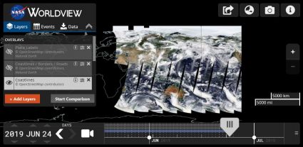
We all know what Earth looks like. But what does it look like RIGHT NOW?
NASA’s Worldview aims at real-time imagery delivery. That is, Earth how it is “right now”. But there’s more:
It shows over 800 layers of satellite imagery. And typically, most have just a 3 hour delay in time.
4 Mapbox
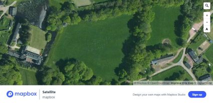
This is quickly becoming one of my go-to satellite maps. It’s because Mapbox removes the clutter and aims for clarity.
First, head over to Mapbox. Next, go to its satellite view. As you zoom in, you’ll see high resolution satellite maps.
It includes imagery from the most iconic commercial satellites such as DigitalGlobe.
5 Esri World Imagery
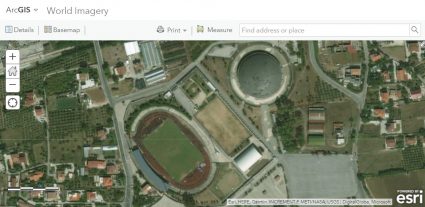
Esri stitches together imagery from 300+ contributors around the globe. The result?
A world imagery layer that is one of the most powerful, up-to-date basemaps today.
Quickly and effectively, you can view satellite maps down to 3cm in pixels. That’s the size of a tiny pebble!
6 Esri Wayback Atlas

Esri’s Way Back Atlas is like going through a time machine. Similar to Google Earth Pro, you can selectively choose from satellite maps back in time.
But this atlas holds a secret wealth of information. For example, New York has 100+ satellite maps dating back to 2014.
Esri’s World Imagery layer (#5) serves as the best available of all satellite maps… But Esri’s Way Back Atlas puts you in the driver’s seat for what’s “best available”.
7 Bing Maps
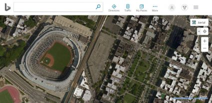
If I could give you one tip for satellite maps, it would be to not ignore Bing Maps.
Don’t get me wrong: Bing’s street views are sparse and it doesn’t have oblique views like Google Maps.
But Bing Maps still serves 10+ TB of imagery. While some imagery can be years out of date, populated areas still have frequent updates.
8 HERE Maps
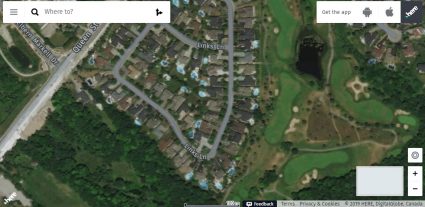
As a company, HERE focuses on navigation, traffic patterns and self-driving cars.
But as part of its platform, it delivers satellite maps for drivers. What I’m referring to is its HERE map.
When you head over to HERE, you’ll first notice its squeaky clean interface. As you pan around, you get a range of satellite maps to explore.
9 Planet Explorer
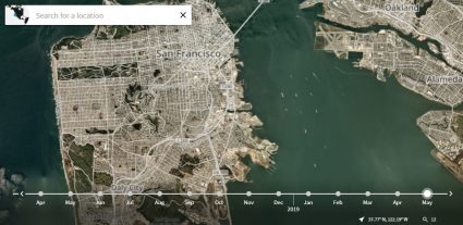
Planet Explorer is like the goldmine of satellite maps. Here’s why:
It doesn’t just show satellite maps from 120+ micro satellites. But you get nearly daily updates at 2.5 m resolution
There’s only one catch: First, you’ll have to register an account. It’s free for the first 15 days. But after that, you’ll have to pay.
10 MapQuest
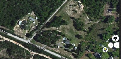
When you visit MapQuest, you’ll get an automatic feeling of nostalgia.
Sure, it’s a map that’s trying to sell you a hotel. But it’s not all bad: MapQuest leverages services from TomTom giving you a mixed bag of imagery.
MapQuest was once popular in the 90s. Admittedly, it’s still not much of a map. Unless it’s on a “Quest” for a better “Map”. Just waiting for that day to come.
11 Yahoo! Maps
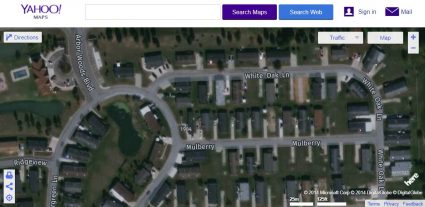
Yahoo! Maps is like the Hall Mary of satellite maps. In fact, it’s been defunct since 2015.
Yahoo had a legitimate 8-year run. Yet somehow, they still haven’t powered it down.
Its satellite maps are behind its competitors in several regards. For example, it lacks 3D, street views and imagery updates.
12 MDA NaturalVue
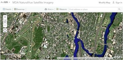
For a coarse view of the Earth, MDA NaturalVue is at 15 meter resolution. Just to give you perspective on what that means:
First, find a soccer field on the map. Then, count the number of pixels. If you count 20 or so, it’s so coarse that you won’t even be able to recognize center field.
Sure, NaturalVue is old. It’s even a bit of a wildcard. But it’s a bona fide hit if you’re looking for consistent world imagery.
Chapter 2. Beyond Visible
13 Landsat Explorer
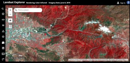
The launch of Landsat-1 in 1972 was a hingepoint for space satellites. It was a milestone moment which prompted the 40+ years of archiving our planet’s history.
Hundreds of satellites have followed Landsat’s path into space. But it wasn’t just in color.
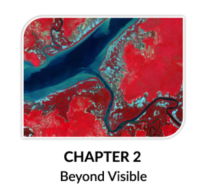
In the Landsat Explorer, you can see the world in new ways like near infrared, a spectral index or like how our eyes see it.
14 Sentinel Playground
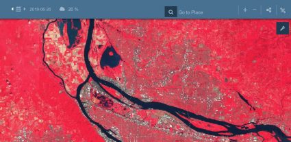
The Sentinel Playground lives up to its name. Because the truth is: Satellite maps aren’t just for pretty pictures.
For example, the 12 indices in the Sentinel Playground characterize Earth’s features differently.
It’s like those little Russian Dolls: You see layers upon layers. Each one is a proven way that can help you get to the bottom of distinguishing anything.
15 USGS Earth Explorer
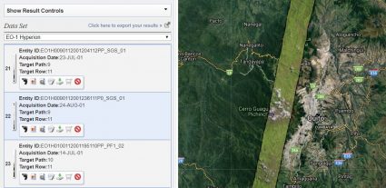
USGS Earth Explorer gives users 45+ satellite platforms to browse through. But you don’t have to download data. You can simply preview ANYTHING.
For example, it’s the only source where you can view hyperspectral imagery on-the-fly. Not only that, but you can unlock spy satellites like CORONA from the 1960s.
Overall, USGS Earth Explorer rewires how you see satellite maps. Because seeing is believing, give it a test-drive.
16 Leaflet
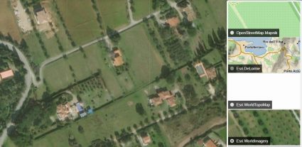
Leaflet allows anyone to build lightweight web maps they can call their own.
As part of Leaflet, it has a range of free tile providers. For example, Esri, Geoportal France and CartoDB are all there.
A cool feature is that when you pan, it interactively updates each provider’s map.
17 Cesium

Similar to Leaflet, Cesium lets users build their own customized webmaps.
But because Cesium is all in 3D, viewing is off the charts.
The Cesium Viewer is joined by satellite maps like Bing, Esri and Mapbox.
Chapter 3. Humanitarian Satellite Maps
18 Tomnod/GeoHIVE
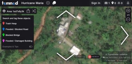
Tomnod leverages the power of crowdsourcing during times of crisis. For example, Tomnod is best known for its platform search for flight MH370.
Regardless of the campaign, Tomnod can be a treasure trove for satellite maps. Anyone who doubts it should look at its past campaigns Tomnod proves we don’t need MacGyver on the case. Instead, we need the power of crowdsourcing.
After 9 years and kilometers of satellite imagery, DigitalGlobe is shifting the Tomnod platform to GeoHIVE.
19 DigitalGlobe Open Data
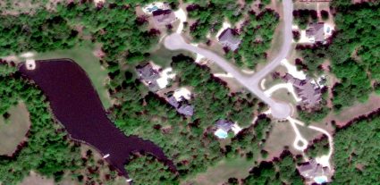
DigitalGlobe has two flavors of open data:
First, its Open Data Program supports major global crisis events like earthquakes, hurricanes and forest fires. That way, those who need it can get the support they need. During these humanitarian events, they release each photo into the public domain under the Creative Commons 4.0 license.
Secondly, DigitalGlobe has product samples available for around the globe. For example, sample imagery products are available for Rio de Janeiro (Brazil), Stockholm (Sweden) and Washington DC (USA).
Chapter 4. Weather Forecasting
20 NOAA Weather Radar
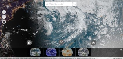
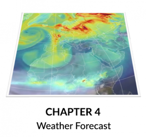
NOAA’s 3D map is the first out-of-the-gate. The trick to this one is how it gives you near real-time weather.
In this global map, you can see the weather from space as it would appear from our eyes.
Alternatively, the near infrared lets you tackle the challenge through a different lens.
21 GOES Viewer
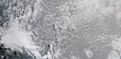
GOES knows weather. These geostationary satellites update our weather every 5 minutes. But how do you see it?
First, head over to the GOES Imagery Viewer. Next, select your target region.
This will lead you into satellite maps for weather. Finally, choose your view and get an updated snapshot of satellite weather.
22 Latest 24
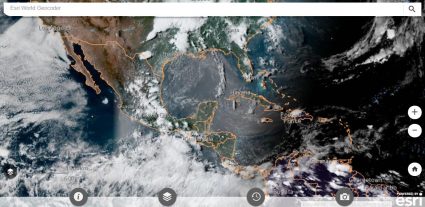
As NOAA satellites silently circles Earth, we get a preview of our planet from space.
Instead of a 3D perspective, NOAA has built a set of satellite maps that targets weather with a top-down view.
In fact, you can interactively fast-forward and rewind the weather from the last 24 hours each day.
Chapter 5. Specialty Satellite Maps
23 Night View
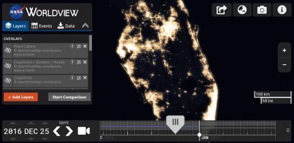
How does Earth look like at night? And what is the extent of human settlement on the landscape?
By stitching 400+ images from space, NASA had compiled the most comprehensive night view in its black marble map.
As seen in this night view map, major cities illuminate the sky the most. Overall, this gives us a ballpark figure for how much humanity has inhabited the land.
24 Global Forest Map
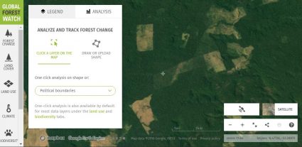
When a tree falls in the forest, satellites hear the impact. Anyone who doubts the severity of deforestation can browse it in the Global Forest Watch.
First, go to the Global Forest Watch. By default, cleared forests are on. Countries like Indonesia, Brazil and Peru light up.
If you zoom in, it has satellite maps like Planet’s 120+ constellation – the paid one (#9) I mentioned above.
25 NASA’s Fire Information for Resource Management System (FIRMS)
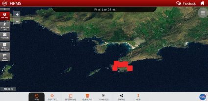
When wildfires roar, satellites track where they burn. Specifically, they capture wildfires as they happen and stream it through active fire maps like FIRMS.
Yet somehow, there’s a curious disconnect between those fighting fires on the ground.
Satellites sensors like MODIS and VIIRS make use of thermal infrared. Only then, we can detect fires as small as a hot spot… all the way up to volcanic eruption.
Conclusion
We’ve put an all-out-effort equipping you with the best satellite maps.
Now, it’s your turn:
You now have a competitive edge for space imagery.
But what’s your favorite? And what did we miss?
Go to our comments section below.
Top 6 Free LiDAR Data Sources
By: GIS Geography · Last Updated: August 10, 2020
How to download free LiDAR data online
Does it feel like a big challenge to find LiDAR data sources?
How about free LiDAR data sources?
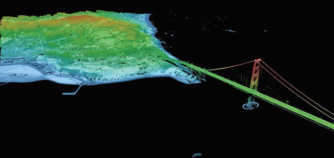
We understand. LiDAR is a beast of a dataset to work with. What other GIS formats have its OWN compression format (LAZ). C’mon! Have you ever seen a shapefile with its OWN compression format?
This fact alone makes LiDAR repositories national treasures in GIS.
So, as Dr. Evil would say pinky in the mouth – BRING OUT THE LASER

(Laser for LiDAR, of course). We’re bringing out the lasers in this special post on 6 free LiDAR data sources.
1 Open Topography
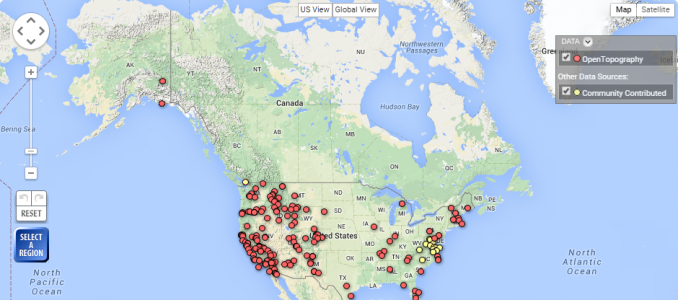
Open Topography has made our list of the 10 best free global raster and vector data sources. And rightfully so.
If you don’t know about Open Topography, you should probably take a peek. The beauty behind Open Topography is its open community system. When users register, they can upload their data so that the larger community can access it.
You too can help grow Open Topography into one of the biggest open data portals for free LiDAR data. Pretty neat.
- Open Topography is a collaborative data repository for LiDAR users.
- Intuitive web map displays LiDAR points as downloadable data with metadata
2 USGS Earth Explorer
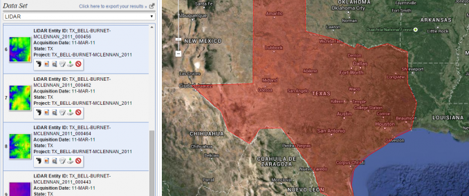
Previously, users could access USGS LiDAR data through CLICK (Center for LiDAR Information Coordination and Knowledge). However, this service is now being provided by the USGS Earth Explorer.
So you want USGS Earth Explorer LiDAR data? If you’re new to this platform, we have a quick guide to download data on the USGS Earth Explorer.
For LiDAR, it’s a simple process:
First, enter your search criteria (KML, coordinates, etc.). Next, select the checkbox for LiDAR in the data sets tab. Finally, click the results tab to see what LiDAR datasets are available.
- Search for LiDAR data with a user-friendly state-of-the-art interface
- Filter searches by time and set region of interests in map by predefined areas and coordinates
Also, USGS Earth Explorer sits on top of our 15 free satellite data sources, so it’s definitely worth your time to know it inside out.
3 United States Inter-agency Elevation Inventory

There’s been a movement in the United States for a National LiDAR Dataset . This initiative is being led by the United States Inter-agency Elevation Inventory (USIEI). NOAA and USGS are spearheading this collaborative effort.
Several states have already moved forward in their own collections. To see exactly which states they are, the USIEI Inventory gives you this information along with vertical accuracy, point spacing, and date of collection. Downloading the physical data is not so straight-forward. The National LiDAR Dataset Wikipedia page maintains download source locations.
- LiDAR sources are decentralized with partial and incomplete data across the United States
- USIEI LiDAR data viewer displays the nationwide listing of known high-accuracy topographic data
4 NOAA Digital Coast
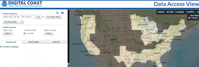
NOAA’s mission (in the sense of LiDAR data) is clear. Overall, they want to capture coastal area LiDAR data. Then, they serve this data openly to the public.
NOAA’s Digital Coast webmap gives you the ability to know exactly where coastal LiDAR is located in the United States. This makes your search for coastal LiDAR data a no-brainer. Go with NOAA.
- Slick web application to search, analyze and download free LiDAR data.
- Draw area of interest and click LiDAR data download.
5 National Ecological Observatory Network (NEON)
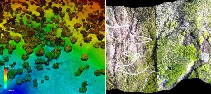
One of the cool things about the National Ecological Observatory Network (NEON) is that they are funded by the National Science Foundation. Another neat thing about NEON is the amazing work they are doing with airborne LiDAR to map out vegetation stands.
Although some of NEON’s data may not have sufficient QA/QC to meet the end-user’s needs, we still think NEON’s airborne LiDAR data has some serious potential.
- Minimal selection of LiDAR because in construction phase
- Beginning of a collection of publicly available LiDAR
6 LIDAR Data Online
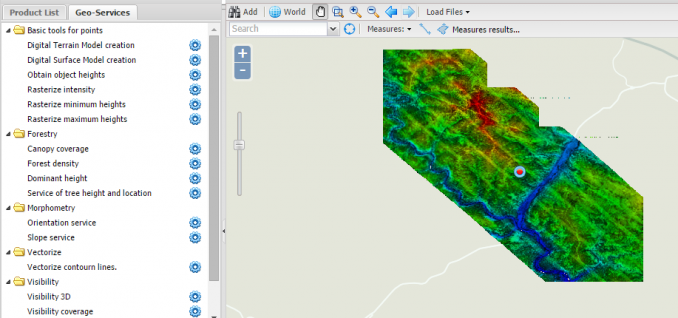
Who knows? This may be where the future of LiDAR is going – a global LiDAR map . Don’t laugh. We have the Earth mapped with optical imagery already.
LiDAR Online’s mission is ambitious. No matter where you live, this data source shows you exactly where on Earth is LiDAR. Admittedly, a little bare now in terms of LiDAR sources, LiDAR Online shows a lot of promise.
- LiDAR spans the globe – mostly Europe, North and South America and Africa.
- Webmap with points delineating free LiDAR data sources.
Summary: LiDAR Data Sources
Before reading this article, you probably thought free LiDAR data was hard to come by?
Now, you know it’s not so bad.
We’ve provided you with 6 free LiDAR data sources options.
Instantly, you’ve mastered the art of attaining LiDAR point cloud data at no cost .
Regards

